Reading the land
Start with what the land can carry.
How a site is read for a lagoon-led community: why high ground matters more than size alone, why wetlands stay as landscape, and the questions any community’s land should answer.
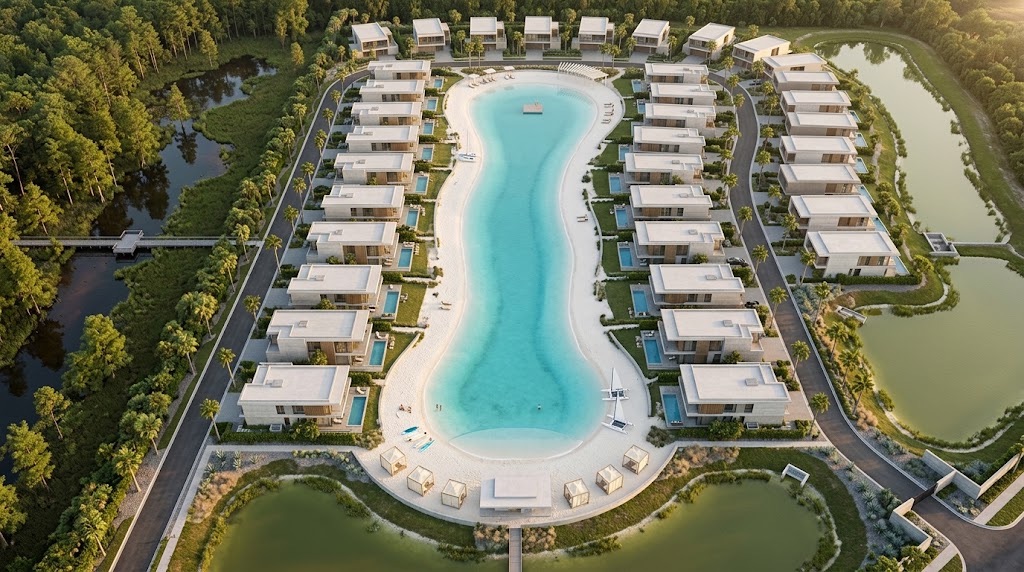
Why uplands matter
The water is planned on high ground.
An amenity lagoon is engineered water. It is planned on uplands: higher, drier ground that can be shaped, lined, and cared for over time.
Wetlands do another job. They hold water, filter it, and shelter wildlife, so they are conserved as landscape: edges to walk beside, views to look across, and green space that stays green.
That is why the developable share of a site matters more than its gross size. A modest site with generous, connected high ground can carry more of a plan than a larger one that is mostly wet. A desktop screen looks for that balance early, and a formal delineation by qualified professionals confirms it later.
Read more in Lagoons belong on uplands.
The size of a site is a number. Its high ground is the plan.
Reading a site
A site is read in layers.
Access comes first: how people and services reach the land. Then the ground itself: where it sits high and dry, where water stays, and what the soils will bear. Then the edges: roads, neighbors, utilities, and the places people already go. Read together, the layers show what a site could support long before any plan is drawn.
Questions worth asking
What to ask about a community’s land.
Select the topics you care about. The result is a printable list, with a note on what a good answer covers.
Your result
Your land questions
The topics you selected, each with a note on what a good answer covers. Bring them to any conversation about a community.
This stays on this page. Nothing is sent or stored.
How a site is studied
Four steps from map to plan.
Each step answers a narrower question than the one before, and any of them can change the plan.
- 01
Desktop screen
A review of public maps and records: access, zoning, flood mapping, mapped wetlands, soils, utilities, and surroundings. It shapes questions; it does not reach conclusions.
WhoPlanning team
- 02
Field studies
Survey, wetland delineation, soils, access, and utility capacity, confirmed on the ground.
WhoQualified consultants
- 03
Engineering and design
Grading, drainage, lagoon engineering, and the site plan, drawn on the ground that can carry them.
WhoEngineers and designers
- 04
Permits
Local, state, and, where wetlands or water are involved, federal review before anything is built.
WhoThe reviewing agencies
Questions
Questions about the land.
What does a desktop screen look at?
Public maps and records: parcel lines, access, zoning and future land use, flood mapping, mapped wetlands, soils, nearby utilities, and the pattern of roads and places around the site. It is a first read that frames better questions, not a conclusion.
Is a site with wetlands a weaker site?
Not necessarily. Wetlands are kept as landscape, so what matters is where the high ground is, how it connects, and what it can carry. Kept whole, a wetland can become a community’s quietest edge.
Where can I read more?
Lagoons belong on uplands explains the reasoning, and The land under a community walks through the facts any site should be able to answer.
Where things stand
A general guide.
This page explains how any site is read, not any specific location.
Next step
Picture your home by the water.
Start a planning brief with the setting and the home you have in mind. In this preview, nothing is sent; the brief prints for your records.